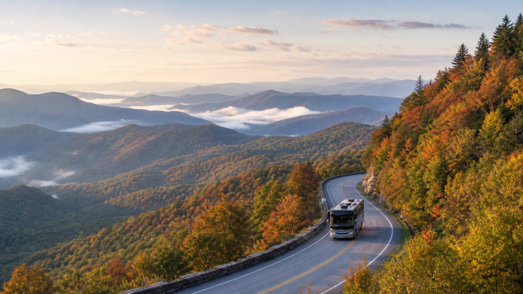
Blue Ridge Parkway RV Trip Planner: Campgrounds, Tunnel Clearances, and Safe Milepost Routing
On a map, the Blue Ridge Parkway appears as an easily understood stretch of mountain road from Shenandoah National Park in Virginia to Great Smoky Mountains National Park in North Carolina: 469 miles long. It is not easy in an RV. Street addresses are not as important as mileposts. Tunnel height matters more than scenery. A 70-mile day can be very full, and a closure can alter your plans before breakfast.
This Blue Ridge Parkway RV trip planner is designed for those who do not want the trip to be stressful, but scenic. Use it to determine if your rig is a good fit for the route, to map out a Blue Ridge Parkway RV route by milepost, to determine where Blue Ridge Parkway RV camping is appropriate, and to decide when a detour is a better choice.
Why the Blue Ridge Parkway Needs RV-Specific Planning
A Scenic Drive Is Not the Same as an Easy RV Drive
The Parkway was intended to be a slow, picturesque road, not an expressway. The charm is in wooded curves, stone walls, long ridgelines, overlooks, and small mountain towns. They are also the reason planning is important when it comes to your RV. The road has grades, curves, thin shoulders at times, bicyclists, wildlife, varying weather conditions, and pullouts that can fill. According to the National Park Service, the speed limit is primarily 45 mph, but may be reduced to 25 or 35 mph. It is the ceiling, not the goal in an RV.
If you typically build RV days of approximately 250 interstate miles, you need to recalibrate the calculations. An RV trip plan for the Blue Ridge Parkway can range from 60 to 120 Parkway miles a day, depending on the size of the rig, the weather, the campground location, and how often you stop.
Who This Route Works Best For
This is the easiest of the Blue Ridge Parkway campervan routes. Clearance is less of an issue with Class B vans and smaller Class C motorhomes, and they tend to have greater flexibility at overlooks and campgrounds. Smaller travel trailers and shorter motorhomes can also be a good choice if the trip is planned carefully.
Tall fifth wheels, long trailer combinations, and larger Class A motorhomes require extra caution. "Can you drive an RV on the Blue Ridge Parkway?" is not the only question you should be asking. Basically, "Will it work for this exact section, at this exact loaded height and length?"
Take the time to verify your loaded RV height, total length, ability to handle mountain grades, and readiness to bypass any challenging sections.
Quick Answer: Can You Drive an RV on the Blue Ridge Parkway?
Yes, many RVs can drive parts of the Blue Ridge Parkway, and many can drive long sections of it. Not every RV should drive every mile.
The largest planning concerns are the clearances, grades and curves of the tunnels, current road closures on the Blue Ridge Parkway, driver comfort, access to fuel, and the fit of campgrounds. A small motorhome with plenty of clearance will have a very different trip than a tall fifth wheel approaching the lower-clearance tunnels in southern North Carolina.
When the height of your RV is near the smallest edge-line clearance of a tunnel, the official NPS road status page indicates a closure, fog or storms reduce visibility, or you are tired before a tunnel-heavy section, detour instead of forcing the Parkway. Good RV-safe route planning is not about determining if the rig can make it. It is about having sufficient margin to maintain control of the drive.
Understand the Milepost System Before You Build the Route
The Blue Ridge Parkway is divided into mileposts. Waynesboro, Virginia is near Milepost 0. Milepost 469 is close to Cherokee, North Carolina. The key big city stops on the way are Roanoke, Boone, and Asheville. The NPS cautions against relying on a car GPS on the Parkway, as locations are not based on street addresses but on milepost markers.
Create your Blue Ridge Parkway milepost guide using each day’s section:
- Start and end milepost for each driving day.
- Campground or exit town by milepost.
- Lower-clearance tunnels and tunnel clusters.
- Fuel, grocery, and detour exits before you need them.
Utilize the navigation system to locate local communities, major highways, and known campground entrances. On the Parkway, trust signs, the official map, milepost markers, and up-to-date road status information provided by the NPS.
Blue Ridge Parkway Tunnel Clearances for RV Travelers
The Tunnel Height Is the First Number to Check
According to the NPS tunnel-height table, there are 26 tunnels on the Parkway, 25 in North Carolina and one in Virginia. Most, but not all, list a minimum vertical clearance of at least 14 feet at the edge-line striping. RV drivers should be mindful of the edge-line number; sometimes the clearance at the center line may be greater, and it is illegal and hazardous to cross the center line to gain height.
The lowest numbers on the NPS table are near the southern end. Big Witch Tunnel at MP 461.2 is listed at 11 feet 7 inches at the edge line and 18 feet at the center line. Lickstone Ridge Tunnel at MP 458.8 is listed at 11 feet 8 inches at the edge line. Those numbers are the reason for placing Blue Ridge Parkway RV tunnel height checks at the top of the plan.
Calculate the Official Height of Your RV Against Its Actual Height
Do not use brochure height as the only measurement. Measure the RV in travel trim, including air conditioners, vents, antennas, satellite equipment, solar mounts, cargo boxes, and anything else installed after purchase. Then add a conservative buffer for road crown, suspension movement, lane position, and driver error.
When your clearance is close, detour. It is a Blue Ridge Parkway scenic drive RV experience best enjoyed when looking at the road and the scenery, not staring at the roofline and hoping.
The Southern Parkway Tunnel Clusters Require Further Consideration
The Parkway tunnels are largely located in North Carolina, particularly to the south of the High Country and through the Asheville-to-Cherokee area. Re-check the NPS tunnel table prior to entering a tunnel-heavy section, turn on low-beam headlights, slow down before entering a tunnel, remain in your lane, and do not pass bicyclists within tunnels.
RV-Safe Itinerary Planning: How Many Miles Per Day?
Distance should not be the basis for a Blue Ridge Parkway RV tour. The day is influenced by overlooks, curves, traffic, weather, and campground arrival windows.
For the majority of RV travelers:
- Three days: Pick one area, e.g., Virginia near Roanoke, the Boone and Blowing Rock area, or Asheville south to Mount Pisgah. Avoid attempting to "do the Parkway" in three RV days.
- Five days: Plan two or three regional bases with short traveling days between them. This works great for a Blue Ridge Parkway motorhome guide of the scenic type, but not the rushed type.
- Seven days plus: Make connections between the bigger sections and leave space for weather, overlooks, closures, and campground logistics.
Each daily plan should contain a shorter alternative, particularly for Blue Ridge Parkway travel trailer owners. A trailer requires a longer time for backing, fueling, turning around, and maneuvering in campgrounds than a van does.
Blue Ridge Parkway RV Camping Options
Developed Parkway Campgrounds
There are eight developed Parkway campgrounds on the NPS list:
- Otter Creek, milepost 60.8 in Virginia
- Peaks of Otter, milepost 85.9 in Virginia
- Rocky Knob, milepost 167.1 in Virginia
- Doughton Park, milepost 239.2 in North Carolina
- Julian Price, milepost 297.0 in North Carolina
- Linville Falls, milepost 316.4 in North Carolina
- Crabtree Falls, milepost 339.5 in North Carolina
- Mount Pisgah, milepost 408.8 in North Carolina
These are the essential RV campgrounds of the Blue Ridge Parkway to consider first, but they are not full-service RV resorts. According to the NPS, Parkway campgrounds are seasonal and are typically open May through late October, depending on weather conditions. The NPS also lists potable water, flush toilets and sinks, RV dump stations, picnic tables, and fire rings. Showers are available at Julian Price and Mount Pisgah, and the NPS camping page lists developed campsites at $30 per night, with advance reservations available for all Parkway campgrounds. Be sure to check the seasonal dates, closures, reservations, and site information before traveling.
Nearby Campgrounds That Have More Amenities for RVers
Look outside the Parkway boundary if you require hookups, wider sites, laundry service, reliable cell phone reception, or easier maneuvering. For larger rigs on the Blue Ridge Parkway, the ideal campgrounds for RVing may be nearby private or public campgrounds with more space and easier access.
Make Sure the Site Is Long Enough and Accessible Before Booking
Do not take it for granted that an RV-friendly campground can accommodate your RV. Review the listing, confirm the maximum site length, check for slope and back-in angle, and review the dump station, water, generator rules, and reservation windows.
Key RV Route Segments to Plan Carefully
Virginia: Rockfish Gap, Roanoke, and Mountain Access
A good introduction to the Parkway can be Virginia. Access is provided near I-64 through Rockfish Gap, and Roanoke is a large service anchor. However, the day can be impacted by grades, weather, limited shoulders, and construction. Take advantage of major roads for access and do not follow GPS down a small road that appears to be shorter.
North Carolina High Country
The following sections are popular and busy: Boone, Blowing Rock, Julian Price, Linville, and the nearby High Country areas. Anticipate busy pullouts, be aware of traffic at popular viewpoints, and research road conditions before assuming a through-route.
Asheville and South
Access to supplies and repairs in Asheville is excellent, with restaurants and campgrounds also readily available. The Parkway gets more tunnel and elevation conscious south of Asheville. Now is the time to be more conservative when planning routes on the Blue Ridge Parkway: tunnel heights, road conditions, weather, and fuel all need another look.
Cherokee End
The southern end near Cherokee flows into Great Smoky Mountains National Park. Treat that as a separate planning step, not an automatic same-day add-on after a long Parkway drive.
Fuel, Food, and Supply Strategy
Please do not use the Parkway as a commercial route. Nearby towns typically are off-route, and usually have fuel, groceries, propane, repair shops, and large parking lots. Look for exit towns that have good access, rather than looking only at distance to the exit; satellite-check fuel stations for canopy height, turning radius, driveway grade, and exit path.
The basic idea: start each Parkway day with enough fuel for the full planned segment, the campground arrival, and the option to detour if the road is closed or conditions change.
Road Closures, Weather, and Seasonal Timing
Road closures may occur due to weather conditions, construction and maintenance, slides, storm damage, or emergency events on the Blue Ridge Parkway. Please refer to the official NPS road status page before publication, before leaving, and the morning of each driving day.
There is a reason spring and fall are popular. Spring brings green ridges; fall brings color and crowds. The summer season can be rich in vegetation and hectic. Closures, ice, and reduced visibility are a possibility during winter and shoulder-season cold snaps.
Driving Safety for RVs on the Parkway
Steep grades, narrow or unforgiving shoulders, limited sight distance, wildlife, bicyclists, overlooks, and changing speed limits are all highlighted as aspects of Parkway driving safety. Those are not footnotes in an RV. Use lower gears on down slopes, take your time at curves, stop when cars are backed up behind you, and skip overlooks that appear too tight to exit safely.
Blue Ridge Parkway RV Planning Checklist
- Measure actual loaded RV height and total length.
- Check the official NPS tunnel-height table.
- Construct a milepost route with fuel, grocery, and detour exits.
- Book or confirm campsites and site length.
- Create offline maps and save the official Parkway map.
- Review the NPS road status page the night before each driving day.
- Analyze all weather at elevation, not only near the town.
- Check edge-line tunnel clearances prior to tunnel-heavy sections.
- Ensure that campground access, generator guidelines, water, and dump station details are confirmed prior to arriving.
FAQ
Is the Blue Ridge Parkway suitable for driving a Class A motorhome?
Sometimes, depending on the precise height and length of the motorhome, the comfort of the driver, existing closures, and the chosen section. Take a measurement of the coach when it is loaded and compare it with the NPS tunnel-height table to decide where to go.
Are travel trailers allowed on the Blue Ridge Parkway?
Conservative planning will allow for travel trailer travel on many sections. Look at combined length, tunnel clearance, campground site length, grades, and safe pulling-over points.
Which of the Blue Ridge Parkway tunnels is the lowest?
Big Witch Tunnel near milepost 461.2 is listed as 11 feet 7 inches at the edge line on the NPS tunnel-height table, with a much higher centerline clearance of 18 feet. Remember that the edge line is the number the driver of an RV should plan around; crossing the center line is unsafe and illegal.
Do Blue Ridge Parkway campgrounds have RV hookups?
Never assume that hookups are available in an NPS Parkway campground. Basic developed campground facilities include potable water, comfort stations, dump stations, picnic tables, and fire rings, with showers at Julian Price and Mount Pisgah. If you need water or electric hookups, check campgrounds in the vicinity and double-check the information before making a reservation.
How long does it take to drive the Blue Ridge Parkway in an RV?
Schedule in phases instead of making an attempt to complete the entire 469 miles in a short period. Three days works for one region, five days allows for multiple highlights, and seven days or more allows for ample time for weather, overlooks, closures, and campground logistics.
Are Blue Ridge Parkway RV camping bookings required?
Reservations are highly recommended, particularly during the busy season and for larger RVs that require particular site lengths. The NPS notes that campsites are available on a first-come, first-served basis and that advance reservations can be made for all Parkway campgrounds, but site fit and seasonal operation should be confirmed before relying on campsites.
Is Google Maps enough for a Blue Ridge Parkway RV trip?
No. GPS is just one tool. Due to the Parkway’s milepost locations, the NPS says car GPS units are not effective on the Parkway. Use official maps, milepost markers, current NPS road status, campground information, and RV-specific route checks.
Final RoadReviewer Advice
Follow the Parkway’s lead. No one has ever said, "That’s the Blue Ridge Parkway, just get it over with." Take a quick measurement of the rig, verify official sources, remain flexible with the route, and allow for the day to change.
RoadReviewer’s curated American RV routes are an excellent resource for additional route ideas beyond this Blue Ridge Parkway motorhome guide. For this drive, however, the one rule you should never forget is that scenic is not easy. Plan it as you would plan an RV trip, and the Parkway will become the kind of trip you will want to slow down for.