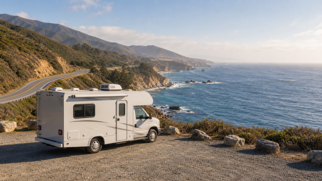
Pacific Coast Highway RV Trip Planner: Campgrounds, Big Sur Cautions, and RV-Safe Highway 1 Routing
Every RVer hears about it at some point; the Pacific Coast Highway with its ocean on one side and cliffs on the other, its state parks set in coves and its postcard views that fill up an RV camera’s memory card before lunch. It’s also one of the easiest drives you can take lightly in California.
A good Pacific Coast Highway RV trip planner is more than just a pretty stops list. The challenge for RVers is determining which sections of Highway 1 are appropriate for your rig, whether or not US-101 is a better option, when to book campgrounds, and when Big Sur is best enjoyed as a day drive rather than a through-route. I’ve been on enough coastal and mountain roads to know this: The best RV trips do not always have every possible destination marked on the map. The best one makes you arrive at camp with daylight, fuel, nerves and options left.
Why the Pacific Coast Highway Needs RV-Specific Planning
Highway 1 Is Scenic, but Not Always Big-Rig Friendly
Highway 1 was NOT constructed as an interstate. The California coast road is a two-lane, curvy, exposed, and limited road, with ocean bluffs, hillsides, bridges, small towns, beach traffic and narrow pullouts. That’s the reason people like it in a camper. That’s also how a 40 foot motorhome towing a car can make a dream drive a white knuckle crawl.
If you’re considering building a Pacific Coast Highway RV itinerary, take the measure of the real numbers: RV length, total combination length, height, width, turning comfort and how much driving the driver is willing to do in a day, on a mountain-coast road. If you haven’t already done that type of pre-trip screening, begin by following RoadReviewer’s steps for RV-safe route planning.
The 5 Primary RV Hazards: Curves, Grades, Pullouts, Closures, and Campground Fit
A single show-stopper is not usually the big risk on a Highway 1 RV route. It’s the little things that add up: a close turn after a downhill slope, a pullout that will not accept oversized trailers, a campground access road designed for back-in but not for the extra length of the trailer, a gasoline station location that has no extra room for your trailer, or a closure that has everyone on a detour, which was not intended for big rigs.
Don’t use car logic for this drive. What may seem a breeze in a sedan can be a chore in a motorhome, particularly if it’s windy, foggy, extremely busy or driven by impatient drivers.
US-101 Can Be the Better Route for RVs
US-101 is not an abject failure. It’s the backbone of a California coast RV trip. At a number of locations, the intelligent idea is to drive up and down US-101 and then turn west onto Highway 1 for particular coastal areas, state parks, beaches, or towns for the travel day. That provides you with the views without having to squeeze your RV through every compact mile.
It’s the same when you’re driving on other scenic RV routes. RoadReviewer’s Blue Ridge Parkway RV trip planner agrees in this respect: If you’re ready to do the road, you should do it in a way that’s comfortable for you and your rig.
Quick Answer: Can You Drive an RV on the Pacific Coast Highway?
Yes, there are safe parts of the Pacific Coast Highway for many RVers to use. The more important question is, however, should your particular RV drive every section of it?
Best Fit: Campervans, Small Class C Motorhomes, and Short Trailers
The PCH fits best in campervans, truck campers, small Class C motorhomes or shorter trailers. They are more convenient in the lane, in the parking at overlooks, and in the state park campground. If your setup is small and you don’t mind driving two lane roads that curve, you can create a rewarding Pacific Coast Highway road trip RV route.
Extra Caution: Large Class A Motorhomes, Fifth Wheels, and Long Towed Setups
Caution is required for large Class A motorhomes, fifth wheels, and long tow-behinds. The basic California length law for vehicles is 40 feet, and motorhomes over 40 feet and up to 45 feet are only allowed on specific routes by Caltrans. Not every state route is appropriate for a long motorhome; please consult Caltrans’ 45-foot bus and motorhome maps. In the case of towing, the total combination length is also a planning number in California and the maximum combination length is 65 feet statewide.
Although a route may be legal, it could be a bad comfort fit due to curves, shoulders, traffic or lack of turnarounds.
Do Not Assume the Entire Coast Is One Easy Route
The PCH isn’t a single highway. There are distinct differences in the way that you drive in southern California beach towns, the Central Coast, Big Sur, Monterey Bay and the Bay Area, and the North Coast. A useful PCH motorhome guide breaks the coast down into decisions rather than making it seem like one smooth line.
Pacific Coast Highway RV Route Overview
Southern California Approach: San Diego, Dana Point, Orange County, and Malibu
SoCal: Be prepared for traffic, beach usage, limited parking, and campground competition. California Highway 1 starts further north, around Dana Point, but San Diego County can play a larger Southern California role. San Onofre, Doheny, Orange County beaches, Malibu – these can be great places to park an RV, but don’t assume you can just do it by the ocean. Reserve this area for beach activities, short drives for scenic routes, and short days of driving, not for long days of miles!
Central Coast: Santa Barbara, Pismo Beach, Morro Bay, Cambria, and San Simeon
A traditional RV camping California coast trip may often be the easiest experience in the Central Coast. Santa Barbara, Pismo Beach, Morro Bay, Cambria, and San Simeon offer a greater balance of RV facilities, coastal parks, grocery stores, dump station availability and US-101 backup routes. This is the best part of the 5-7 day trip for many RVers.
Big Sur and Monterey: The Most Critical RV Decision Point
It is the Big Sur that is worthy of most respect. While it is grand, it is also narrow, vulnerable to storms, has few services and is exposed. Caltrans conditions, rig size, campground availability, weather and driver confidence are all factors to consider when making the Big Sur RV route decision.
If at any time there’s doubt, stage from Monterey, Carmel or the San Simeon/Cambria area and drive chosen segments in smaller car (if available). That might be a more desirable option than attempting to get a complete through drive for some rigs.
Bay Area and North Coast: Half Moon Bay, Marin, Mendocino, and Leggett
Up north from Monterey, the shoreline is still gorgeous, but may get a little trickier and a little slower. There is a need for traffic awareness in Half Moon Bay and in Marin. The northern coast and Mendocino is sometimes winding, isolated and a lot of work. If you’re looking to travel around America as a whole, then consider this area its own trip and not a side road onto a Southern California road trip.
Best Direction to Drive the Pacific Coast Highway in an RV
Northbound vs. Southbound: Views, Pullouts, and Driver Stress
According to the old saying, the southbound side of the road offers the best views of the ocean. In many places, this is indeed the case. However, the ideal direction to travel Pacific Coast Highway RV depends on the traveler driving the rig.
Southbound can put you closer to the edge of cliffs and exposed shoulders. Northbound is slightly easier as the driver is not as close to the drop off but some pullouts are less convenient. Northbound may be the better route to take if the driver is already afraid of heights, traffic, or narrow lanes, although it will lack easy access to some turnouts.
Why Some RVers Prefer to Stage From US-101 and Drive Short Stretches of Highway 1
With larger rigs, the optimum direction is not necessarily either. Follow US-101 as the route of movement, book a campground close to the water, and then travel shorter stretches of Highway 1 with well-defined start and end points. One of the most practical aspects of RV safe route planning California vacationers can apply is: do not let the beauty of the destination fool you into taking a difficult detour; keep RV days short; and keep an exit route known.
Big Sur RV Route Cautions
Always Check Highway 1 Closures Before You Make the Trip
Closures and lane controls in Big Sur may change due to storms, slides, construction or emergency repairs. Do not depend on an outdated blog post, a social media comment or a screenshot of a map from a cache. Always check Caltrans QuickMap and Caltrans District updates before making plans, before leaving and again the morning you enter an area.
As of this Stage 2 fact check on June 9, 2026, Caltrans had reported that the Big Sur corridor had fully reopened earlier in 2026, but current work still matters for RV planning. Caltrans’ May 26, 2026 notice says temporary traffic signals are operating 24/7 at Rocky Creek Bridge, 12 miles south of Carmel, with expected delays of up to 10 minutes and project signals estimated to remain through June 2028, weather permitting. Conditions can change rapidly; it is important for the publication editor to check Caltrans QuickMap again just prior to publication.
Narrow Shoulders, Tight Curves, Cliffside Driving, and Limited Turnarounds
The most difficult aspect of Highway 1 RV restrictions is that the road may be technically open but NOT a good fit for a specific setup. Big Sur’s curves are tight, shoulders are limited, tourists are distracting, cyclists and construction areas can be present, and there are few easy places to turn a long combination. In 2026, a Caltrans speed-limit update also emphasized real roadway conditions in the Big Sur area, such as horizontal curves, the presence of pedestrians and cyclists, driveway access, vehicles parked in pullouts and pedestrian crossings. Avoid the narrow lanes if you feel like you’re going to have to cross the lane in the corners to keep your RV centered.
Last-Minute Detours on Small Mountain Roads Shouldn’t Be Attempted
Avoid being guided on a narrow mountain road by a navigation app because Highway 1 isn’t a good option or is closed. Many inland connectors close to Big Sur are steep, narrow, seasonal, damaged, gated or not suitable for RVs. Any detour should be selected prior to the trip in accordance with the official road status and RV judgement.
There Are Times to Skip Big Sur in a Big Rig
Avoid driving Big Sur during closures and bad weather, high winds, when the driver is uncomfortable, the fit of the campground isn’t certain, or when the only plan involves improvisation. Don’t be embarrassed to take the US-101 route and go to Monterey, Carmel, San Simeon or coastal overlooks from safer staging areas.
Pacific Coast Highway RV Camping Strategy
Get Your Reservations for California State Park Sites as Early as Possible
RV camping on the Pacific Coast Highway is not a show up and see in the busy season. ReserveCalifornia is the inventory system used by California State Parks campgrounds, and inventory for camping and lodging is usually made available on a rolling six month schedule. Popular coastal locations may be booked up quickly. Make appointments on your calendar and don’t think a cancellation will save the trip.
Coastal Camping Areas to Study
Good research target areas are San Onofre, Doheny, Carpinteria, Pismo, Morro Bay, San Simeon, Big Sur, Monterey and Half Moon Bay. Each of these areas is distinct. Some are more suited to access beaches, some to access town services, some to Big Sur staging and some to a slower family stay.
Always refer to official pages when searching for Highway 1 campgrounds RV. Length limits, seasonal status, fees, and changes to campground rules are important on official reservation pages, while third party campground summaries offer ideas.
Verify Max RV Length, Back-In Angle, Hookups, Dump Stations, and Generator Rules
Do not assume that the site is suitable for an RV. Check for RV length, length when towing, shape of site pad, back-in angle, hookups, potable water, access to dump station, generator hours, arrival time, and whether or not the road inside the campground is friendly to your set-up. A 31′ motorhome and a 31′ trailer will act very different in the same campground loop.
Roadside Camping Around Big Sur Is NOT a Backup Plan
Roadside camping is not a legal or respectful alternative around Big Sur and Highway 1 pullouts. Rules for sleeping in cars in parking lots or on the highway vary by land manager and official park page and some specifically forbid both. Make and plan for actual overnight stops. If campsites are full, alter the route inland, shorten the trip or change coast segment. It’s too patrolled and too crowded on the coast, and the coast itself is too fragile to sleep in a turnout.
Section-by-Section RV Itinerary Ideas
3-Day Short Version: Pick One Region, Not the Whole Coast
Avoid trying the Los Angeles to San Francisco RV trip on Highway 1 for 3 days. Pick one region. Malibu and Ventura County, or Pismo to Morro Bay and San Simeon, or Monterey with a well vetted Big Sur outing drive are good short versions. When you shorten the trip, cut down on mileage, and build up buffer time, you will be successful.
5- to 7-Day Central Coast Route
A sensible 5-7 day RV route planner California coast trip might begin near Santa Barbara and then go on to Pismo Beach and Morro Bay, take time in the vicinity of Cambria or San Simeon, and then either go into Big Sur or start heading up US-101 to Monterey, depending on rig size and conditions. You will have beaches, small towns, services, and a number of exits to choose from.
10-Day Slower Route With Campground Buffers
10 days is enough time to take things slow and make it seem more of a trip than a moving day. Make two night stops as much as possible. Add one buffer day at Big Sur or Monterey, depending on the weather, traffic, repairs or fatigue. When you’re in an RV, a buffer day isn’t a day that is wasted. It’s what prevents the route from getting brittle.
How to Add Redwoods Without Overloading the Drive
If redwoods are a part of your dream, then make sure to do so on purpose. Avoid tacking the North Coast route on top of a heavy load Southern California-to-Monterey itinerary. Avoid detours along the coast unless the road and campground make sense, and consider using US-101 as a second route stage with the redwoods.
Fuel, Groceries, Dump Stations, and Turnaround Planning
Do Not Wait Until Big Sur to Solve Fuel
Refuel before out-of-the-way coastal areas, particularly before Big Sur. Access, space to maneuver, and prices are often not as expected. Even a gas station that works for a van may be terrible for a large Class A with a toad.
Satellite-Check Gas Stations Before Committing
Plan for fuel stops, grocery stops and dump stations using satellite view. Check driveway angle, pump configuration, overhead clearance, exit direction, and the ability to exit without backing onto the road. This habit is one of the most effective planning strategies for less stress.
Build Turnaround and Overnight Backup Options Into Each Day
For each travel day, there must be a bailout plan: a turnaround, a connection to US-101, a legal overnight backup, and a max arrival time. The trip plan was unsuccessful if at the end of the day you are still driving the coast in the dark because the day was overpacked.
Best Time of Year for a Pacific Coast Highway RV Trip
Spring: Green Hills, Possible Storm Damage, and Fewer Crowds
While green hills and fewer crowds may be a feature of spring, so can be lingering damage or repair work from storms. Spring is a beautiful, but verification-heavy, time of year.
Summer: Booked Campgrounds, Traffic, and Coastal Fog
The summer season means long days, peak demand, busy campgrounds, beach traffic and coastal fog. Make sure to book ahead and have a short drive day.
Fall: Often the Best Weather Window
Fall is often the best window for a Pacific Coast Highway RV trip planner route: not as many families on summer timetables, satisfactory weather, and just a little bit more breathing room. Fire, smoke and local restrictions remain to be checked.
Winter: Lower Crowds, Higher Closure Risk
Though often quiet and dramatic, winter weather can turn Highway 1 on its head in no time at all. When driving in winter, have alternative routes to US-101 worked out and never plan a trip around the highly vulnerable Big Sur through-drive.
Pacific Coast Highway RV Planning Checklist
Measure Rig Height, Length, and Total Combination Length
Record RV height, RV length, trailer length, total combination length and width. Keep it in the cab. It’s by guessing that RVers make bad decisions about roads and campgrounds.
Check Caltrans, California State Parks, and Campground Pages
Check Caltrans QuickMap, California State Parks, ReserveCalifornia, county parks, federal campground pages and private campground websites before departing. Recheck near Big Sur or remote coastal roads near travel day.
Download Offline Maps and Save Reservation Details
Cell signal may be weak. Download maps, save campground confirmations, screenshot entry guidelines and have phone numbers readily available offline.
Choose Detours Before You Need Them
Plan detours when you’re in a cool state, parked and plugged in. A detour under stress is often not the best detour, particularly if that detour is selected on the shoulder of Highway 1.
FAQ
Is Pacific Coast Highway a safe route for large RVs?
While parts of the PCH may be okay for large-rig drivers, the whole stretch of road shouldn’t be thought of as large-rig friendly. When traveling longer distances, use US-101 and check sections of Highway 1 first.
Can you drive a Class A motorhome through Big Sur?
Yes, depending on length, driver comfort, current road conditions, traffic, weather and closures. Motorhomes longer than 40 feet, but not more than 45 feet, require additional route verification by means of Caltrans’ approved and restricted route guidance.
Are there RV campgrounds on Highway 1?
Yes. Along or near Highway 1 there are state, county, federal and private campgrounds, but availability and size of RVs vary greatly. Check for length restrictions, hookups, dump stations and seasonality on official pages.
Is roadside camping legal on the Pacific Coast Highway?
Be aware that not all roadside camping is permitted. Highway 1 pullouts should not be relied on as an overnight backup, particularly around Big Sur. Make other kinds of plans that involve legal campground, RV park or inland alternatives.
How many days do you need for a Pacific Coast Highway RV trip?
Three days is sufficient for one area. 5-7 days is much better for Central Coast. If you are looking for a more leisurely trip to include Big Sur, Monterey, and, perhaps, the North Coast, allow 10 days or more.
Should RVers take Highway 1 or US-101?
Most RVers should utilize both. Highway 1 is for selected pieces of scenic highway which fit the rig. US-101 is the real world RV highway for better travel days, safer detours, and schedule recovery.
Final RoadReviewer Advice
Don’t see the Pacific Coast Highway as a race. The victory is not an RV driven around every mile of Highway 1. The winning choice is the sections that fit your rig, the season, the campground, the closures, and the driver’s comfort!
In the case of a campervan, this could be a long day along the coast and a load of stops. It could be US-101 travel days with some strategic beach campgrounds for a fifth wheel. In a large Class A, it could be parking in the area of Monterey or San Simeon, then exploring Big Sur from the smaller vehicle.
That is NOT settling. That’s how veteran RVers ensure iconic roads remain fun. Make coastline beautiful, not stressful.